New Citadel (Parthian Citadel)
23 September 2010 | Andrew Wilson/Manar al-Athar (Resource ID: 107018)
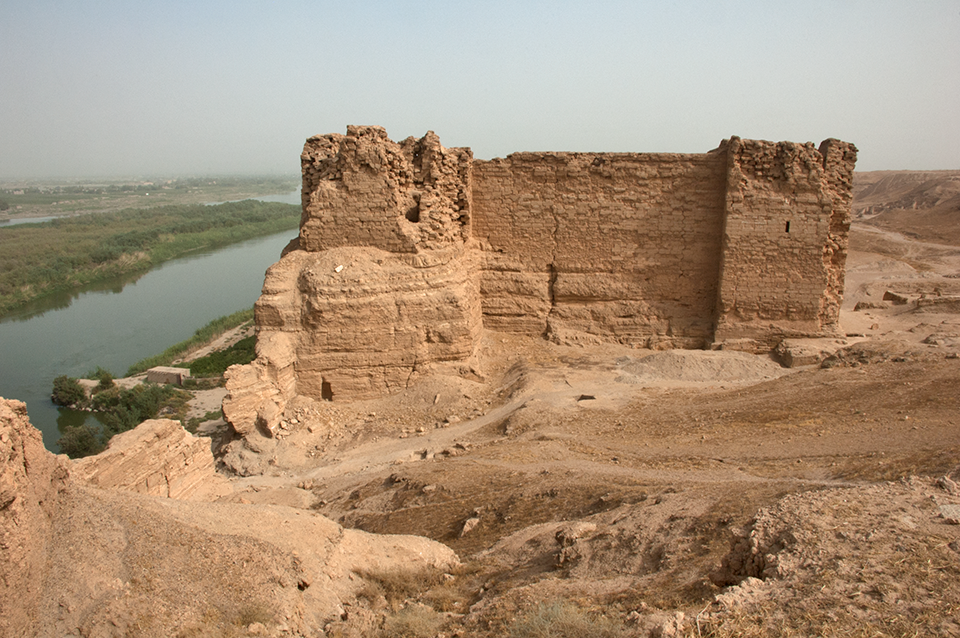
The toponym “Dura” (fortress) is probably a later form of Da-wa-ra, a place named in an Old Babylonian cuneiform tablet discovered reused in a wall of the Temple of Atargatis. Particularly in view of the city’s location in a fertile valley on a cliff above the Euphrates River, a much earlier settlement is highly likely to have existed in the immediate area. The citadel fortification on the east side of Dura shown in this photograph is constructed of gypsum blocks, local stone that was quarried from the wadis on the north and south of the city. The dating of Dura’s fortifications is unclear: construction seems to have started in the Hellenistic period and to have continued into the Arsacid (Parthian) period. Dura’s earliest Hellenistic settlement appears to have been located in and around the citadel, as the Mission Franco-Syrienne Excavations (MFSED) excavations have determined. The citadel was one of the first structures excavated during the Yale-French excavations: contemporary reviews indicate, however, that the city’s architecture and the use of mudbrick and local stone did not initially impress the team. This photograph was taken six months before the conflict in Syria began in March 2011: subsequently, Dura has been devastated by intensive looting.